Trail · Guide
Trail running in Las Vegas, and where off-trail is allowed
Where to trail run around Las Vegas, which land managers allow cross-country travel and which ask you to stay on trail, plus the heat, water and navigation basics that keep a desert run from going sideways.
Rules checked Nov 1, 2026 against BLM, NPS, USFS and city pages

Short answer: The best trail running near Las Vegas is in Cottonwood Valley (34.9 miles of designated trail off SR 160), Bootleg Canyon (more than 36 miles in Boulder City) and Red Rock Canyon. Truly off-trail running is mostly a no: BLM asks you to stay on established trails at Red Rock. Cross-country travel is accepted in parts of Lake Mead NRA and the Sloan Canyon wilderness, but only if you avoid fragile soil crust.
Searches for “off-trail running” in Las Vegas usually mean one of two things: runnable dirt instead of pavement, or literally leaving the trail. The first is easy here. The second depends on whose land you’re on, and in the Mojave the stakes are higher than they look. A single footstep can crush living soil crust, and the desert tortoise, a threatened species, lives across this valley. Here’s what each land manager actually says, then the routes worth your legs.
Can you run off-trail in Las Vegas? The rules by area
| Area | Manager | What the rules say |
|---|---|---|
| Red Rock Canyon NCA | BLM | Stay on established trails. If you must go off trail, follow rock outcrops, washes, or sand and gravel free of plants and soil crust. Source |
| Cottonwood Valley & Blue Diamond area | BLM (inside Red Rock NCA) | Use the designated trail system. BLM counts 34.9 designated miles and 31.95 miles of unauthorized trail out of 66.85 known miles. Source |
| Lake Mead NRA | NPS | Few established trails; the NPS suggests exploring on foot across open rock expanses. Avoid crusted (cryptogamic) and gypsum soils, don’t collect anything, and keep wilderness groups to 12. Source |
| Sloan Canyon NCA (North McCullough Wilderness) | BLM | Cross-country hiking is allowed in the wilderness except in the Petroglyph Management Area and its north access, where you stay on designated trails. No dogs in the wilderness. Building trails is trespass. Source |
| Bootleg Canyon | City of Boulder City | Stay on trail, don’t trample into the desert, and don’t alter or make new trails. Some trails are hiker-only. Source |
| Spring Mountains NRA (Mt. Charleston, Lee Canyon) | USFS | Obey closures. The upper Bristlecone Trail has been closed since Tropical Storm Hilary (Aug 2023), and a butterfly collection closure covers upper Lee Canyon through 2031. Source |
Red Rock Canyon: stay on trail
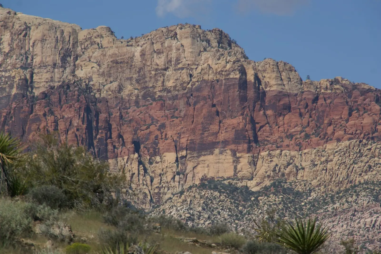
BLM’s guidance is direct: please stay on established trails. Biological soil crust can take up to 50 years to recover in the Mojave Desert. If you have to leave the trail, BLM says to follow rock outcrops, washes, or patches of sand and gravel that are free of plants and crust. The exception is after storms. BLM warns to stay out of drainages then because of flash floods. Don’t feed the burros, and know that cross-country travel by OHV is prohibited.
Cottonwood Valley is part of Red Rock NCA, and it shows why this matters. BLM counted 66.85 miles of known trail there, of which 34.9 miles are designated and 31.95 miles are unauthorized, user-made routes. Run the designated system. If a line isn’t on the land manager’s trail map, it isn’t part of the trail network.
Lake Mead NRA: cross-country is normal, with care
The NPS says more than 87% of Lake Mead National Recreation Area protects Mojave Desert, and there are few established hiking trails. The park says perhaps the best way to explore is on foot, across open expanses of rock formations. The park asks you to avoid cryptogamic (crusted) soils and gypsum soils, which are habitat for the rare bear poppy, and not to collect anything. Wilderness groups are capped at 12 people. Driving off roads is prohibited. The NPS also says summer hiking is not advised, never hike alone, and carry at least a gallon of water per person.
Sloan Canyon: open wilderness, protected petroglyphs
BLM’s approved management plan for Sloan Canyon allows cross-country hiking throughout the North McCullough Wilderness, except in the Petroglyph Management Area and its north access, where you must stay on designated trails. Dogs aren’t allowed in the wilderness, and building trails is treated as trespass. Petroglyph Canyon is limited to 20 people at a time and is open 8 AM–4:30 PM. There are no restrooms at the trailhead. BLM has also posted that the trailhead is closed from November 12, 2024, to November 11, 2026, while a visitor contact station is built, with the Petroglyph Canyon and 101 trails rerouted and parking moved to Democracy Drive. Check the alerts before you drive out.
Bootleg Canyon: stay on trail, watch for bikes
Boulder City’s trail commandments for Bootleg Canyon say it plainly: stay on trail and don’t trample into the desert, don’t alter or make new trails, and human power only. Water is your friend. Bootleg has more than 36 miles of trails, beginner-friendly down low and technical up high. Nevada Trail Finder notes that some trails are hiker-only and some bike-only, that hikers yield to bikes on shared trails, and that summer is very hot.
Spring Mountains (Mt. Charleston and Lee Canyon): mind the closures
The Forest Service’s Spring Mountains NRA covers 317,000 acres, from about 3,000 feet to 11,918 feet on Charleston Peak. Up here the rules come from specific closures. The upper part of Lee Canyon’s 6.3-mile Bristlecone Trail has been closed since Tropical Storm Hilary in August 2023, and the Upper Bristlecone Trailhead (8,650 ft) is closed with no restrooms or potable water. A Forest Service closure order also bans collecting butterflies in upper Lee Canyon through July 2031 to protect the endangered Mount Charleston blue. That order covers collecting, not off-trail travel, but fenced host-plant areas along the trail are there for a reason. Stay outside them.
Legal trail running routes near Las Vegas compared
| Route | Where | Distance | Surface | Water & restrooms | Best season |
|---|---|---|---|---|---|
| Cottonwood Valley (Late Night Trailhead) | SR 160, about 15 mi west of I-15 (NPS) | 34.9 mi of designated trail (BLM) | Singletrack and dirt roads | Restroom, no water (NPS) | Oct–May (SNMBA) |
| Red Rock Canyon: Calico Hills | Scenic Drive, Red Rock Canyon NCA | 6.6 mi round trip, 1,640 ft gain (BLM) | Sandstone and dirt | Water only at the visitor center (BLM) | Cooler months; timed entry Oct 1–May 31 |
| Bootleg Canyon | Boulder City (1000 Yucca St trailhead) | More than 36 mi of trails (Boulder City) | Rocky; lower trails easier, upper trails technical | Not published | Fall and winter (Nevada Trail Finder) |
| Sloan Canyon NCA | Henderson (south) | Petroglyph hike 5.5 mi (BLM) | Desert trail and wash | No restrooms at the trailhead (BLM) | Petroglyph area 8 AM–4:30 PM |
| Lee Canyon: Bristlecone Trail | Spring Mountains NRA | 6.3-mi loop; upper section closed (USFS) | Mountain trail | Upper trailhead closed; no water there (USFS) | Summer escape (elevation) |
| River Mountains Loop Trail | Henderson, Boulder City, Lake Mead | 34-mi paved loop (NPS) | Paved | Water near the Lake Mead Visitor Center (NPS) | Winter, spring, fall (NPS) |


Cottonwood Valley is shared with mountain bikers, and our sister site has a Cottonwood Valley trail guide. For paved long runs, the River Mountains Loop Trail and Red Rock’s Scenic Drive are on our training routes page. Newcomers on r/trailrunning regularly ask how to find people to run trails with in Vegas, so a local running club’s group trail runs are a good way to learn the routes.
Heat, water and navigation
- Heat: BLM says Red Rock temperatures can top 110°F, and the NPS says Lake Mead can reach 120°F in the shade. The Southern Nevada Health District tells athletes to exercise in the early morning or evening and avoid midday. Check temperature.vegas/heat and the best time of year before planning a long run.
- Water: BLM recommends 4 liters a day in summer and says the Red Rock visitor center is the only place to fill up. Trailheads and the backcountry have none. The Late Night Trailhead has a restroom but no water.
- Navigation: Load the managing agency’s trail map before you leave, and tell someone your route and return time. BLM offers voluntary hiker registration at the Red Rock visitor center.
- Flash floods: Washes are the recommended off-trail surface in dry weather and the worst place to be in a storm. Stay out of drainages when storms threaten.
- Wildlife: Don’t touch or pick up desert tortoises, and don’t disturb their burrows. Don’t feed burros or wild horses.
- Partner up: The NPS says to never hike alone at Lake Mead. The same goes for running.
Racing on dirt? Look for trail races on our race calendar, and if you’d rather walk, see our guide to hot girl walk spots in Las Vegas.